Control maritime activity by tracking ships
We provide solutions for maritime security by combining data from SAR satellite imagery and AIS ship data. Using artificial intelligence, we enable the automatic detection of rogue ships whose AIS transponder has been switched off, aiding authorities and port administration in maintaining marine safety and security.
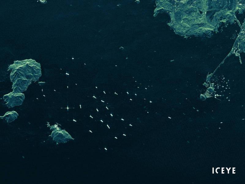
SAR satellite data
By utilizing synthetic-aperture radar (SAR) satellite data, continuous around-the-clock observation of maritime zones is possible, at high-reslution and unhindered by weather conditions or day-night cycles. The world's largest SAR satellite constellation allows sub-daily revisits and is especially suited to detect vessels at open sea.
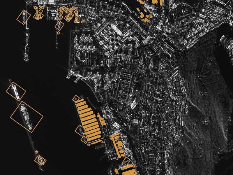
Vessel detection using AI
By employing artificial intelligence models in the field of object detection, we enable the automatic detection of vessels at sea with high accuracy. We use specialized high-performance computing clusters, which allows out solution to provide rapid and precise reports on rogue vessels. Factual information of ship locations georeferenced to their exact longitude and latitude can thus be obtained over a vast maritime area.
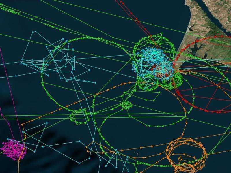
AIS anomaly detection and tracking
By comparing factual data obtained from SAR satellite images with information emitted from AIS transceivers, data anomalies are detected which allow the identification of vessels that present anomalous behavior and eases the task of law enforcement on the open sea. For example, the lack of AIS data for a vessel may indicate an attempt to hide illegal activity, such as fishing in territorial waters.
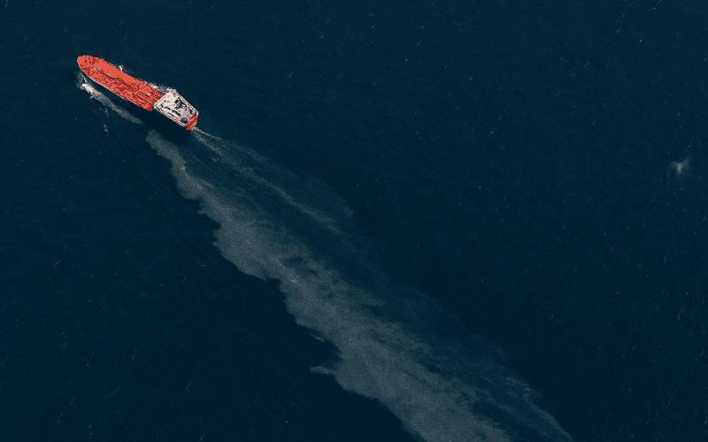
Marine oil spill detection
Reliable detection of marine oil spills using an extensive SAR satellite constellation. Day and night tracking of small and large spills with actionable data within hours of acquisition, including identification of the source and predicted trajectory. Essential in order to mitigate further environmental and economic harm and to filing claims against maritime polluters.