Truth.
Through continuous observation of the Earth.
We provide objective naval intelligence for security, monitoring and optimisation; facilitating decision-making that contributes to resilience, sovereignty and sustainability.
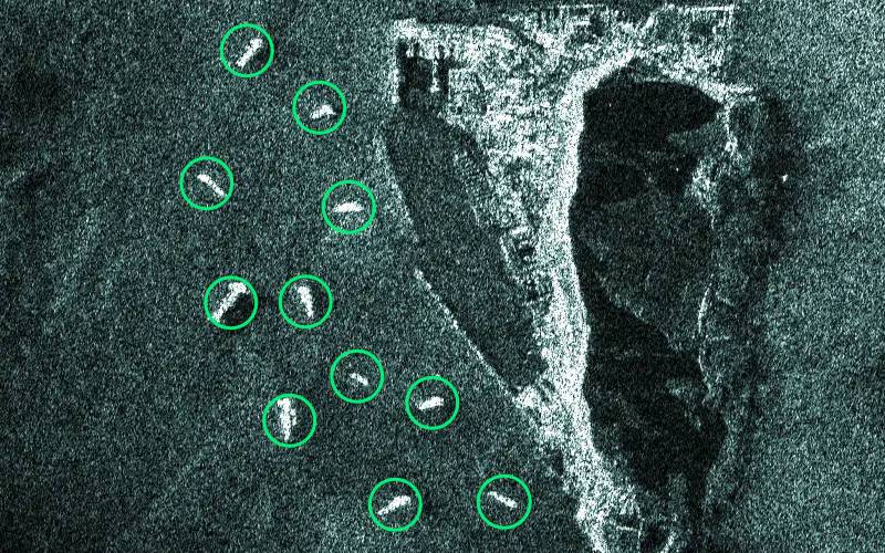
Dark Vessels
Utilizing synthetic-aperture radar (SAR) and radio frequency (RF) satellite data, continuous around-the-clock observation of maritime zones is possible. We can detect vessels instantly using our state-of-the-art AI models and by cross-examining with AIS ship data we identify all dark vessels, including those involved in illegal fishing, smuggling, immigration or an adversary's vessel.

Oil Spills
Reliable detection of marine oil spills using an extensive SAR satellite constellation. Day and night tracking of small and large spills with actionable data within hours of acquisition, including identification of the source and predicted trajectory. Essential in order to mitigate further environmental and economic harm and for filing claims against maritime polluters.
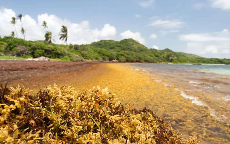
Algae & Sargassum
Detection of algae or sargassum blooms that affect marine life and tourism using hyperspectral imagery. By measuring the exact spectral profile of the object of interest, a reliable distinction can be made between different but similar types of biomass. This allows us to accurately detect and subsequently track slicks of sargassum, as well as predict which beaches are most affected so that reponse teams are more effective.
Anomalies, Tracking & Assessment
By analysing real-time information emitted from AIS transceivers, data anomalies are detected and fleet can be tracked. Tracing historic trajectories by cross-referencing with satellite observation, a sanctions profile can be assessed and risks can be identified.